
Drone services for southwest minnesota
the aerial advantage
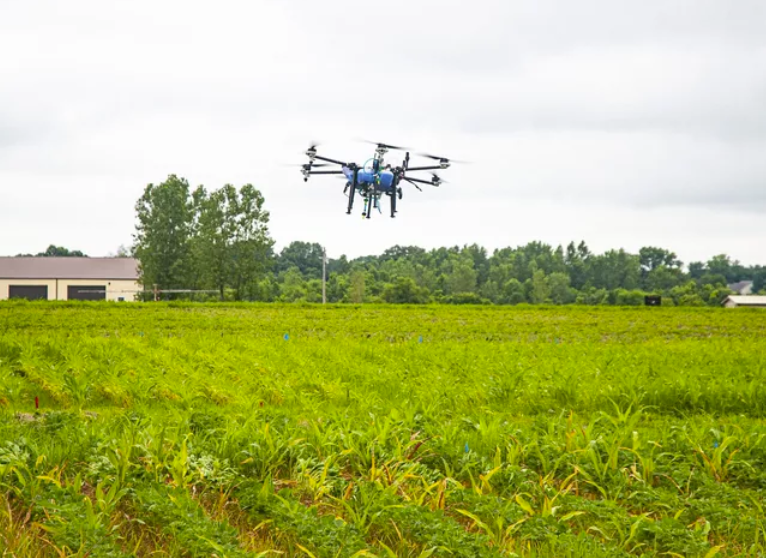
ARC Drone Solutions delivers effective, reliable, and cost efficient drone services for farms, homes and businesses. With increased safety and RTK-level precision, modern drone technology offers several benefits.

Agricultural
Drones deliver precision and efficiency to farm operations. Agricultural drone services include:
Aerial Spray Application (Fungicide, Pesticide, Foliar, Herbicide*, Livestock Fly Control*)
Aerial Dispersion (Granular Fertilizer, Seeding/Cover Crop)
Plant Health Assessments, Application Prescriptions
Field Mapping, Imaging & Aerial Photography
Inspections (Barns, Grain Complexes, Pasture)

RESIDENTIAL
Preparing for a special event? or maybe you’re just trying to avoid using your ladder? Drones can help! Residential drone services include:
Mosquito spraying
Aerial Videos & Property Photography
Inspection of Roofs, Gutters, Chimneys, Solar Panels and other hard to reach spaces

Commercial
Drones can provide a safer and more efficient alternative to a number of commercial projects, including:
Aerial Inspections (Pipelines, Power Plants, Powerlines, Solar Panels, Wind Turbines, Buildings, Bridges, Construction Sites, Railways, Ditches and Waterways)
Aerial Photography and Video (Real Estate, Marketing, Events, News Reporting)
Wildlife surveys and conservation; Eco-restoration
Emergency Response (Disaster Assessment, Search & Rescue)

About us
ARC Drone Solutions was built out a desire to improve accessibility of drone services in southwest Minnesota. In recent years, drone technology has advanced significantly to offer a number of practical solutions with unparalleled benefits. As with most new technology, adoption can be challenging, especially when subject to unique regulations and licensing. ARC Drone Solutions is dedicated to bridging that gap, by providing reliable drone services and educational resources.

-
Bryce grew up on a farm in rural southwest Minnesota, and has had a career in aviation since 2008. In addition to flight instruction, he flew offshore oil and gas contracts in the Gulf, and later moved into EMS. Bryce currently splits his time between being a pilot, a farmer, a husband, and a dad to three fantastic kids…who also like drones.

-
Ben grew up in Idaho, Connecticut, and Arizona. Served 4 years in the U.S. Army and has been a pilot for over 20 years. Over his career he has been a Flight Instrument Instructor which is when he met Bryce in 2009. Ben flew in the Gulf, serving the Oil & Gas industry, followed by flying EMS for many years. He is currently a pilot for North Memorial Health and raises goats and chickens in his spare time. Ben has been married to his wife Erin for 23 years and is a proud dad of five amazing kids!
Articles & CASE STUDIES
-
![]()
Drone Technology Offers New Approach to Combat Weeds
Successful Farming | Feb. 6, 2023
-
![]()
The Comparison of UAV and Airplane Application in Corn
MU Extension YouTube | Mar. 2025
-
![]()
Unlocking the Full Potential of Drones in U.S. Agriculture
DJI ViewPoints Blog | Nov. 2024
-
![]()
Enhancing the Inspection of Critical Infrastructure With Drones
Commercial UAV News | Sept. 2023
-
![]()
How Drones Can Use Multispectral Imagery to Fight Pests
Entomology Today | Jan. 2020
-
![]()
Drones in Plant Disease Assessment, Efficient Monitoring, and Detection
MDPI Agronomy Journal | May 2023


FAQs
-
Arc Drone Solutions uses the DJI Agras T50.
Highlights:
Agricultural Use: Specifically designed for tasks like crop spraying, spreading fertilizers, and surveying.
AI-Powered: Equipped with AI and vision sensors for precise operations. Omnidirectional radars provide 360° scan for obstacles.
High-precision Spraying: Ensures accurate spraying of pesticides and fertilizers with minimal waste. 10.5-gallon liquid tank. 4 spray nozzles (adjustable rate and droplet size), 36-foot swath.
Autonomous Flight: Supports autonomous flight paths for spraying and surveying. GPS and RTK-enabled.
Multispectral Imaging: Compatible with multispectral cameras for crop health monitoring. HD camera.
Large Coverage Area: Ideal for covering large agricultural fields with increased payload capacity and larger spraying width. Range up to 3.1 miles
Efficient Battery Life: Optimized battery management system for extended flight time.
Weather Resistant: Built to handle challenging weather conditions like wind and rain, with a IP67 rating.
-
In the U.S., the Federal Aviation Administration (FAA) regulates commercial drone use, setting rules on flight altitude, no-fly zones, and pilot certification. Recreational drones do not require a license, however, a Part 107 Remote Pilot Certificate is for commercial, government and other non-recreational use. Additionally, the drone(s) must be registered and have a N-number with the FAA. For commercial spraying, a Part 137 Certificate is required in addition to a Commercial Applicators License, other special exemptions are needed for drones over 55 lbs and night operation. These regulations and license requirements ensure safe and legal operation of the drone.
-
Drones can capture large amounts of data, and there are specialized software platforms for analyzing this data. Drones can be used to create 3D maps, generate topographical models, monitor crop health, or inspect infrastructure.
Different types of drone imaging:
Optical Cameras (RGB): Captures high-resolution images and videos.
Infrared Cameras (IR)/Thermal Imaging: Detects heat signature.
Multispectral Cameras: Captures data across multiple wavelengths beyond the visible spectrum.
LiDAR (Light Detection and Ranging): Uses laser pulses to measure distances to the ground and create highly accurate 3D models of landscapes.
Reporting Capabilities:
Aerial Images or Videos
Orthomosaic Maps
3D Models and Point Clouds
Thermal Imaging Reports
NDVI (Normalized Difference Vegetation Index) Reports
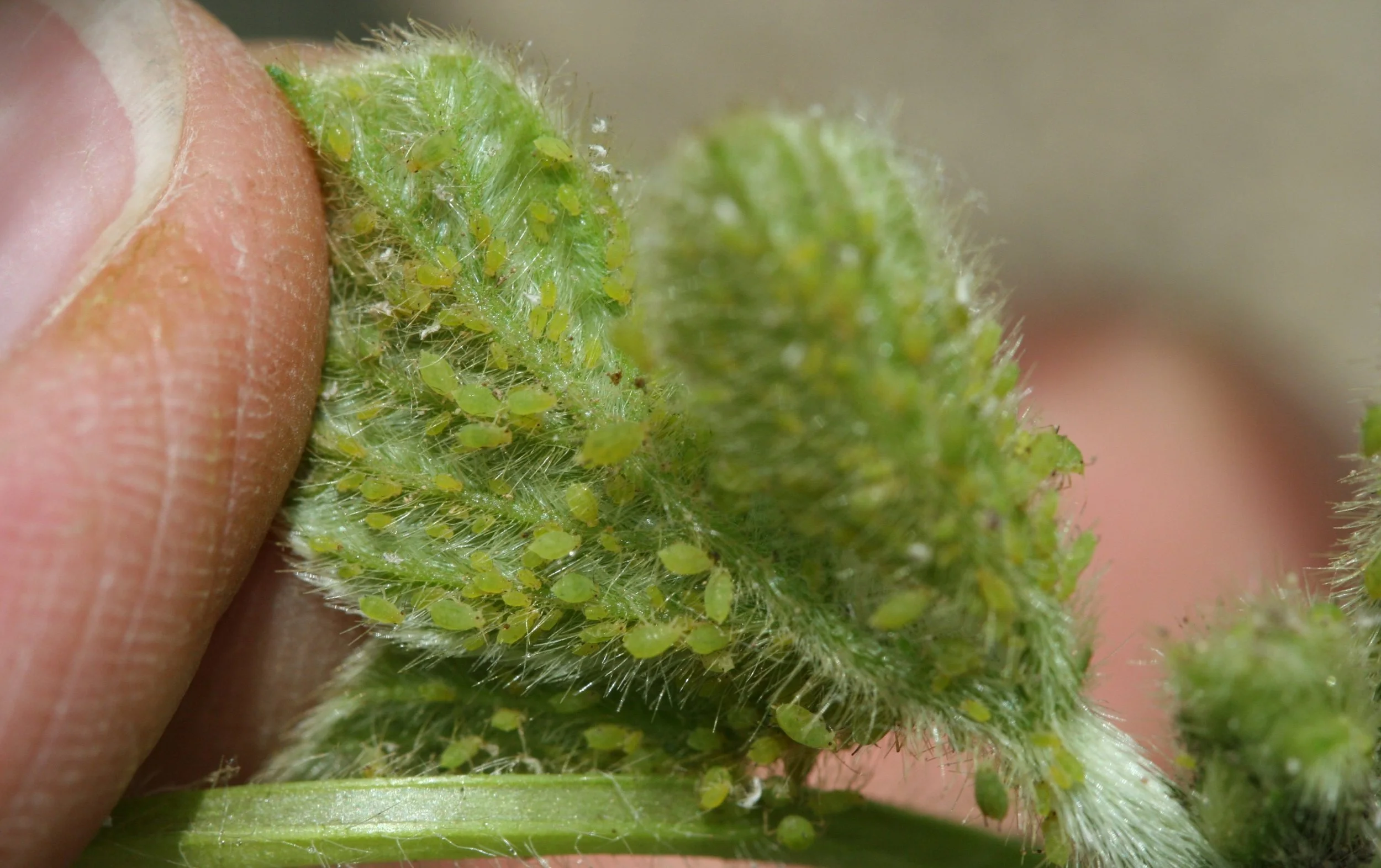
Crop Pest Detection
Surveying and Topographic Reports (Elevation maps, Drainage, etc.)
Inspection and Maintenance Reports
Stockpile Volume and Aerial Measurements
-
For decades, airplanes have been used for ag spraying in situations where a ground rig is not practical. Drones can accomplish the same aerial approach, with several advantages, making this technology the way of the future.
Less Waste: Drones offer a more precise approach to spraying, eliminating overspray and application to areas that do not need treatment. Battery operation and no return trips to an airport also means a more eco friendly operation.
Safety: Drones are unmanned, small, highly maneuverable and programmed to detect obstacles. Airplanes rely significantly on the pilot to observe physical obstructions, such as powerlines, which is the most common cause of crashes.
Performance: Less waste, and more safety sounds great - but do drones get the job done as well as airplanes? Studies have shown yield on drone sprayed fields to be equal to or greater than fields sprayed by airplanes. With drones, spray application to field edges is significantly more accurate, resulting in more consistent coverage to end rows while minimizing spray drift.
Time: A single T50 drone (35ft swath) can cover an 80 acre field in less than two hours. Two T50 drones, less than one. Airplanes (65 ft swath) can spray an 80 in around 45 minutes.
Contact us
If you are interested in a quote or learning more about our services, don’t hesitate to reach out! Our schedules fill up quickly, but we will do our best to respond to your inquiry as quickly as possible.